


Voting District 0417048, Nassau County, New York
About
Outline

Summary
| Unique Area Identifier | 631320 |
| Name | Voting District 0417048 |
| County | Nassau County |
| State | New York |
| Area (square miles) | 0.05 |
| Land Area (square miles) | 0.05 |
| Water Area (square miles) | 0.00 |
| % of Land Area | 100.00 |
| % of Water Area | 0.00 |
| Latitude of the Internal Point | 40.76264930 |
| Longtitude of the Internal Point | -73.59937380 |
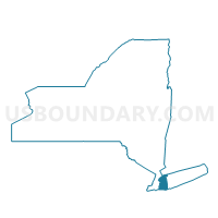
Maps

Graphs
Select a template below for downloading or customizing gragh for Voting District 0417048, Nassau County, New York


Neighbors
Neighoring Voting District (by Name) Neighboring Voting District on the Map
- Voting District 0415001, Nassau County, NY
- Voting District 0415002, Nassau County, NY
- Voting District 0415013, Nassau County, NY
- Voting District 0416108, Nassau County, NY
- Voting District 0417014, Nassau County, NY
Top 10 Neighboring County Subdivision (by Population) Neighboring County Subdivision on the Map
Top 10 Neighboring Place (by Population) Neighboring Place on the Map
Top 10 Neighboring Unified School District (by Population) Neighboring Unified School District on the Map
- Westbury Union Free School District, NY (26,294)
- Carle Place Union Free School District, NY (9,416)
- East Williston Union Free School District, NY (8,834)
Top 10 Neighboring State Legislative District Lower Chamber (by Population) Neighboring State Legislative District Lower Chamber on the Map
- Assembly District 17, NY (136,600)
- Assembly District 15, NY (135,528)
- Assembly District 16, NY (134,747)